How does land surveying work?
Practical Engineering・2 minutes read
Surveying is essential in civil engineering for legal boundaries, infrastructure locations, and topography, with Theodolites and total stations being crucial tools. At home, tools like sight levels and laser levels can be used for topographic surveys, with the water level method offering versatility in leveling without a direct line of sight.
Insights
- Theodolites are crucial tools in surveying, measuring angles between points, with modern versions like total stations also recording distances, aiding in accurate data collection for civil engineering projects.
- Utilizing tools such as water levels and laser levels allows for cost-effective and accessible topographic surveys at home, offering a simplified alternative to complex trigonometry methods, ensuring accurate results for various terrains.
Get key ideas from YouTube videos. It’s free
Recent questions
What tools are essential for conducting a topographic survey at home?
To conduct a topographic survey at home, essential tools include a sight level, water level, and laser level. These tools allow for the measurement of relative elevations without the need for complex trigonometry. The sight level helps in determining horizontal lines, the water level method provides easy leveling without a direct line of sight, and the laser level offers a quick and precise way to measure horizontal lines for surveying purposes.
How do theodolites contribute to civil engineering projects?
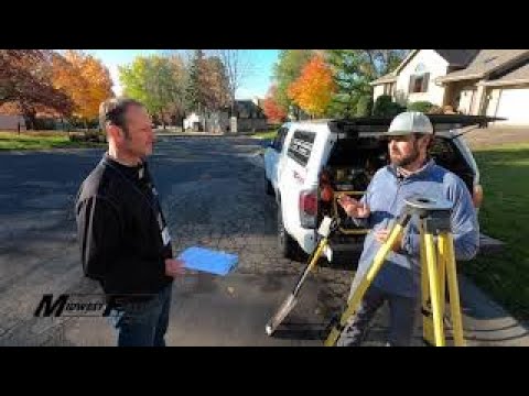
Theodolites are essential surveying tools used in civil engineering projects to measure angles between points accurately. These instruments play a crucial role in determining legal boundaries, existing infrastructure locations, and land topography. Modern versions of theodolites, such as total stations, not only measure angles but also distances and can record data, making them indispensable for surveying tasks.
What is the water level method in surveying?
The water level method in surveying involves using a clear tube filled with liquid to achieve easy leveling without requiring a direct line of sight. This method is versatile for various terrains as it allows for precise leveling by observing the liquid's surface. By utilizing the water level method, surveyors can accurately measure elevations and ensure the alignment of structures without the need for complex equipment or calculations.
How do laser levels aid in surveying projects?
Laser levels provide a quick and precise way to measure horizontal lines in surveying projects. These tools emit a laser beam that creates a visible line on a surface, allowing surveyors to accurately determine elevations and alignments. While laser levels offer efficiency in surveying tasks, they may require waiting until dusk for better visibility of the laser line, ensuring accurate measurements and reliable results.
What is the significance of surveying in civil engineering projects?
Surveying plays a crucial role in civil engineering projects by determining legal boundaries, locating existing infrastructure, and analyzing land topography. Through accurate surveying techniques, engineers can gather essential data to plan and design construction projects effectively. Surveying ensures precise measurements, alignment, and elevation calculations, contributing to the successful implementation of infrastructure developments and the overall safety and functionality of civil engineering projects.
Related videos

Kelvin Academy
SOLVE FOR THE CLOSED TRAVERSE SURVEYING (Real Life Site Construction Calculation)
Midwest Fence
How A Surveyor Locates Your Property Lines

Mark Scheller
How to Find the Property Lines of Any Home (Version 3)

OTENBuildingCourses
Surveying 1 - Introduction to leveling

KUSurveyor
How to Use a Digital Theodolite - Part 1 of 2


Summary
00:00
Essential Tools for Civil Engineering Surveys
- Surveying is crucial for civil engineering projects, involving determining legal boundaries, existing infrastructure locations, and land topography.
- Theodolites are essential surveying tools used to measure angles between points, with modern versions like total stations also measuring distances and recording data.
- To conduct a topographic survey at home, tools like a sight level, water level, and laser level can be used to measure relative elevations without complex trigonometry.
- The water level method, using a clear tube filled with liquid, allows for easy leveling without requiring a direct line of sight, making it versatile for various terrain.
- Laser levels provide a quick and precise way to measure horizontal lines for surveying purposes, although they may require waiting until dusk for better visibility.


